Tomato150
Lord of Altera
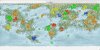
Maps
- - -
- - -
Now that the nations in NationStates have settled in and RP is going, I was thinking about further developing and expanding out with a series of maps that would highlight numerous features about the world, from open trade routes to ore deposits to population density to diplomatic alliances. If these maps were to be made, more than likely the community will have to help a fair bit to get the maps balanced. The goal of the creation of such maps would to be:
- Creating a clear and easily referable source of information
- Making sure resources and other items are in check (( Everyone can’t have diamond mines. ))
- Clear any confusion that is around currently.
In short, I like maps, and I am willing to create a buttload for the NationStates world.
A list of maps
- - -
Agriculture- - -
- Foodstuffs production
- Eventually a buttload of different types of food production ( Corn, Wheat, Rice, ect. )
Cultural
- Religions of the world
Earth Systems
- Time zones | (Final and labeled)
- Tectonic plates | (First and unlabeled) (Second and unlabeled)
- Predicted earthquake hotspot
Environmental
- Human footprint
- Renewable energy usage
- CO2 emmisions
Historical
-?
Note for this category: I'll need people to gib me maps for this one. Basically, all that's needed is a map of the land with a set of dates showing when it's valid.
Political
- Chimeran Commonwealth Authority
- The Ocean Assembly Authority
- The Astenbech Pact Authority
- Sphere of influence
Last edited: